Within Work Package 3 of the WATRUN project, the working group Water Sensitive Infrastructure Planning (WASP) within Helmholtz Centre for Environmental Research is developing a planning tool for NBS for stormwater management. The planning tool is based on the MUST-B approach, which divides a highly complex urban environment into simple modular units that can be easily scaled and used to perform stormwater runoff simulations.
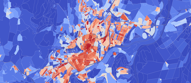
Within the WATERUN Project the MUST-B approach has been further developed. A beta version of pyBlock package has been integrated to the MUST-B. pyBlock uses open source data such as Open Street Map, Urban Atlas and Global Human Settlement Data and discretises an urban catchment into urban blocks. It also calculates the impervious and pervious areas within the block, defines the potential spaces for the NBS. In addition it attributes the sealing degree and the population density per block (Figure 1).

![]()
Figure 1: pyBlock automatic generation Blocks for the city center of Santiago De Compostella
Another step in the further development of MUST-B approach is the identification of the maximum space for the planning of NBS within the blocks. The maximum potential area to implement an NBS is defined as the biggest possible rectangle that fits within the pervious area of the block (Figure 2). A python module has been developed and integrated into pyBlock package for this purpose.
With the newly developed pyBlock package, now we will be able to create blocks for MUST-B analysis for any cities within Europe.
Authors: Ganbaatar Khurelbaatar, Daneish Despot, Maria Chiara Lippera and Jan Friesen